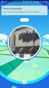
 Pokemon Go has officially released in North America, Australia, New Zealand and Japan and we’re already walking into walls hunting for those elusive pokemans!
The new app, available on both iPhone and Android, involves getting players to travel around the real world searching for and capturing wild pokemon, which appear on your phone screen while you view the scenery through its camera. This gives the effect of the pokemon actually appearing in the real world – which is something many fans (of all ages!) have dreamed about for the last 20 years since the franchise’s inception.
Pokemon Go is fascinating not only because of its wish-granting capabilities, but because of the technology behind it. Geographic Information Systems (GIS) are systems that capture, store, check and display data related to the surface of the Earth. We’ve seen this on GPS software, where the program displays a map of your location, often with 3d attibutes. Ingress, a mobile game very similar to Pokemon Go, uses the same technology.

GIS can even display the terrain of the location, so when you’re hunting Pokemon in a park the app will actually show that you’re in a grass area – which means grass and bug type pokemon, like Caterpie, Venonat, and Bellsprout will pop up on your map. Go near water and you might expect to see Seadra, Magikarp, and Starmie. This neatly mimics the experience of playing the game as pokemon can be found in their preferred habitats, bringing the augmented reality authenticity to an impressive level.
Students interested in learning more about GIS can take the elective course CIT 351 – Geographic Information Systems taught by Professor Dan Farkas. The class is a hands-on introduction to GIS that uses industry-leading software to enable students to build their own GIS models and applications.

 Show us your pokemon! Let us know if you’ve spotted any in the Pace area (we’ll share!) and, most importantly, if you’re interested in a Seidenberg Pokemon League!
I caught that Krabby, by the way → → → → → →


![Pokemon Go brings all our dreams to [augmented] reality](https://seidenbergnews.blogs.pace.edu/files/2016/07/Screenshot_2016-07-07-08-47-20_resized-tc8hsp-e1467902179191.png)